Tropical Depression Near the East Sea Strengthening Rapidly
A tropical depression near the East Sea is expected to strengthen into a storm within the next 24 hours.
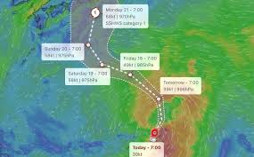
A tropical depression has developed near the East Sea and is forecasted to strengthen into a typhoon, possibly reaching typhoon status by the end of the week. The Philippine Atmospheric, Geophysical and Astronomical Services Administration (PAGASA) issued a storm warning on September 22, indicating that the depression, identified as LPA 09g, is located southeast of Luzon, approximately 1,870 kilometers away.
The depression currently has maximum sustained winds of 45 km/h near its center, with gusts up to 55 km/h and a central pressure of 1,004 hPa. It is moving northward at a speed of 15 km/h, with strong winds affecting an area of about 200 km from its center.
According to PAGASA, over the next three days, the tropical depression is expected to move primarily in a west-northwest direction and may enter the Philippine Area of Responsibility (PAR) by the morning of September 24. Upon entering PAR, it will be given the local name Queenie.
As it approaches the PAR, PAGASA anticipates that the system could strengthen into a tropical storm before entering the area and may reach typhoon status by the weekend. After the five-day forecast period, there is still a possibility for further intensification.
However, for the next three days, the tropical depression is not expected to have a direct impact on weather conditions or sea conditions in the Philippines and surrounding regions. PAGASA advises the public and disaster risk management agencies to continue monitoring updates on the system's development.