New Proposal for Compensation and Resettlement When Land is Reclaimed
A new draft of the Land Law proposes changes to compensation and support for individuals affected by land
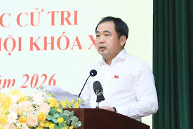
The Secretary of Hanoi, Trần Đức Thắng, has clarified the approach to land recovery for the Red River Corridor project during a recent meeting with voters. He stated that the city will not arrange for temporary housing for affected residents until resettlement areas are fully developed. This initiative is part of a broader urban development strategy aimed at transforming the northern part of the city into a dynamic regional center.
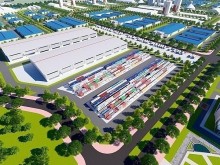
Thắng emphasized the importance of ensuring a smooth transition for residents whose land will be reclaimed. The city plans to develop multi-purpose urban areas and resettlement sites equipped with adequate infrastructure in neighborhoods such as Thư Lâm, Lĩnh Nam, Đông Anh, and Long Biên. The Secretary also mentioned that the city is currently reviewing land availability along transportation corridors to facilitate the establishment of these resettlement areas.
The Red River urban planning project is a significant undertaking for Hanoi, with extensive discussions held by the City Party Committee to align with the resolutions of the Central Party and the capital's long-term vision. Thắng assured residents that the planning will be conducted cautiously, with a focus on scientific assessment, flood prevention, and the preservation of historical sites and villages in the area.
Regarding compensation and support for residents affected by land recovery, the Secretary indicated that the city is seeking public input to ensure that the highest policies are implemented for the residents. The resettlement options may include relocation within the same area or nearby districts, ensuring that residents have access to complete infrastructure.
The city is currently gathering public opinions on the Red River urban planning project, which spans 40 kilometers from Hồng Hà Bridge to Mễ Sở Bridge, covering 16 districts and neighborhoods. The project consists of 18 components and is set to be implemented through a long-term program lasting until 2038, with varying priorities and conditions for execution.
In the initial phase, priority will be given to constructing two main roads, riverbank reinforcement, public parks, and resettlement areas. From 2026 to 2030, the city aims to focus on developing the scenic boulevard along the river, riverbank management, and public parks. The remaining components will be completed based on the readiness of detailed planning, professional assessments, and available resources.
Once the adjusted urban planning for the Red River is approved, the city will develop a comprehensive implementation plan, with timelines adjusted as necessary based on changes in assessments, land availability, resources, or technical solutions.