

Trekking ‘roof top’ Lang Son
Phia Po Peak (Mountain Cha), 1,541 m high, still has a pristine beauty, is a new trekking point for many
The feeling of conquering a mountain peak in the Northwest, watching the sea of clouds floating, and the brilliant sunrise on the first days of the new year will be unforgettable.
Phia Po, Lang Son
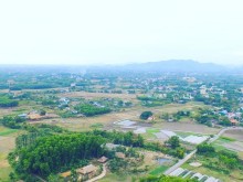
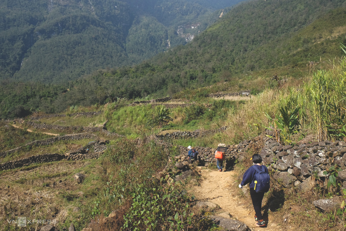
Phia Po Peak, also known as Cha Mountain, is located in the Mau Son mountain complex, nearly 200 km from Hanoi. Located at an altitude of 1,541 m above sea level, Phia Po peak is a new trekking spot on the tourist map, so it retains a lot of unspoiled beauty.
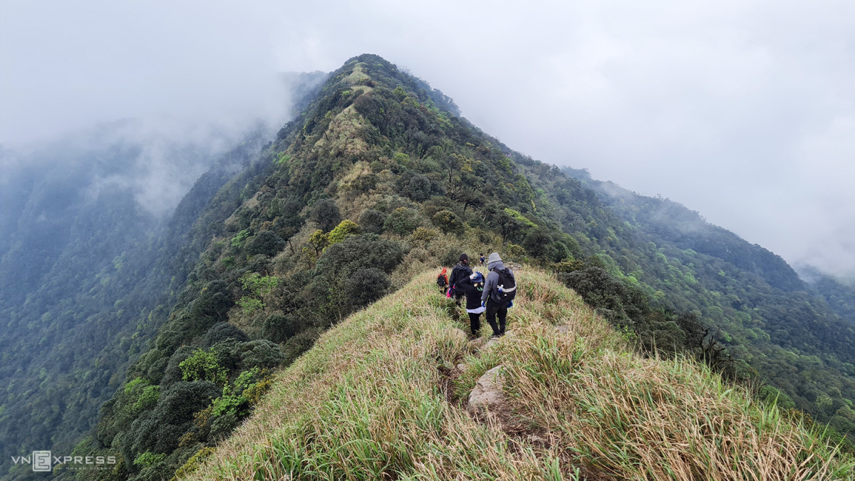
From Hanoi, tourists often choose a 2 day 1-night schedule, take a car or motorbike to the foot of the mountain and hire a guide and porter to go with them. The journey to conquer Phia Po is divided into 2 stages. On the first day trekking 3.5 km from the foot of the mountain to the camping site, set up a tent to eat and stay overnight. The second day continued the uphill move to the highest peak of the same length. Photo: Van Hong
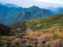
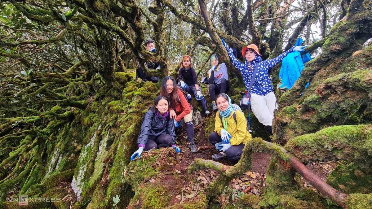
The road is not long but passes through diverse terrains of forests, streams, and grassy hills with consecutive high slopes. At the end of this year, visitors can easily see the sea of clouds floating in the second leg. Especially when reaching the top, not only taking pictures to check-in at the stainless steel top marking the height, visitors can also explore the ancient green mossy rhododendron forest nearby. Photo: Van Hong
Lung Cung, Yen Bai
Located at an altitude of 2,913 m, Lung Cung peak is named after a village located deep in the rugged mountains of Nam Co commune, Mu Cang Chai district, about 270 km from Hanoi.
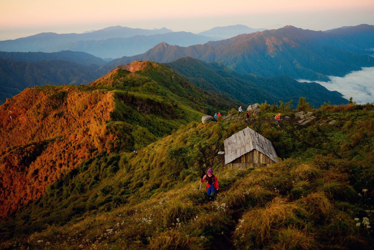
This trekking is at medium difficulty level, strong people can climb during the day but most choose to go for 2 days with a night stay in the mountain shack. However, to get to the starting point, visitors need to rent a motorbike to carry 15 km, bad roads, then an 11 km steep climb to the top. Photo: Nguyen Viet Hung
In return after the hard journey is the mountain scenery overlapping with the primeval vegetation and many precious herbs. Lung Cung Peak is a flat land about 1 hectare wide covered with grasses. From here, you can see the whole Lung Cung valley, Che Cu Nha commune of Mu Cang Chai district, communes of Van Ban district of Lao Cai province… Photo: Thu Phuong
Lao Than, Lao Cai
Lao Than is 2,860 m high in Y Ty commune, Bat Xat district, about 80 km from Sapa town and nearly 350 km from Hanoi. This is an easy hike for even beginners. Tourists from Hanoi often take the night car to Sapa early in the morning and then continue to Phin Ho village to start their 2 day 1-night climbing journey. Currently, due to the ease of the road, Lao Than is welcoming a lot of guests in the winter, which is also the season of hunting clouds and climbing mountains. Photo: Mr. Chiem
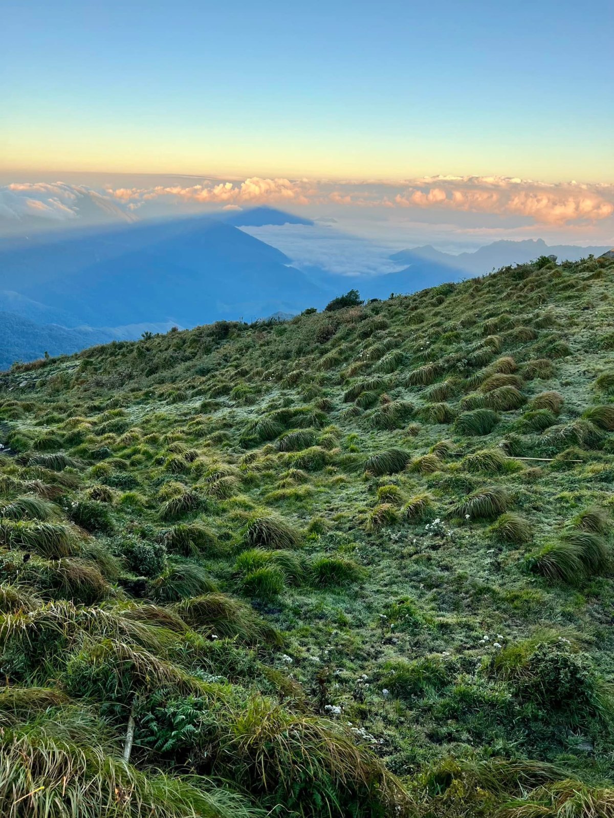
The topography of the road is not too complicated, the vegetation is not diverse, mainly dry forests, grass hills and small shrubs. However, Lao Than is a place where it is easy to see a sea of clouds floating like a fairy scene. If you climb quickly, you can watch the sunset on the afternoon of the first day and go to the top to check in before dawn the next morning. Photo: Mr. Chiem
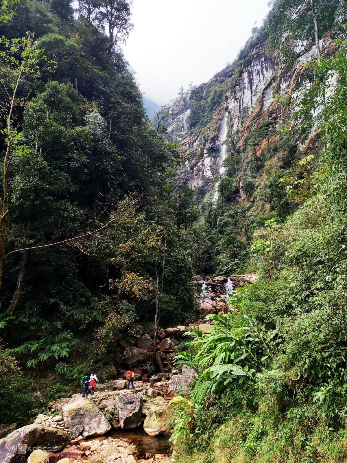
Nhiu Co San, Lao Cai
The mountain is located in Sang Ma Sao commune, Bat Xat district, Lao Cai province, about 60 km from Sapa, Nhiu Co San (2,965 m) is the 9th highest mountain in Vietnam. Currently, tourists who want to trek this peak often take a bus to Sa Pa, continue to Den Sang commune, continue to pick up motorbike taxis of local people to Nhiu Co San village. Photo: Huong Chi
The journey to conquer Nhiu Co San also lasts 2 days and 1 night, going up in the direction of Ong Chua waterfall and on the road to grazing goats of the people or vice versa. On the first day, guests will cross many streams, waterfalls, cardamom forests, maple, bamboo … before coming to the shack for the night. The second day usually starts at 3-4 am to catch the sunrise and watch the sea of clouds. The climb has medium difficulty with many slippery slopes, especially after crossing Ong Chua waterfall. Photo: Huong Chi
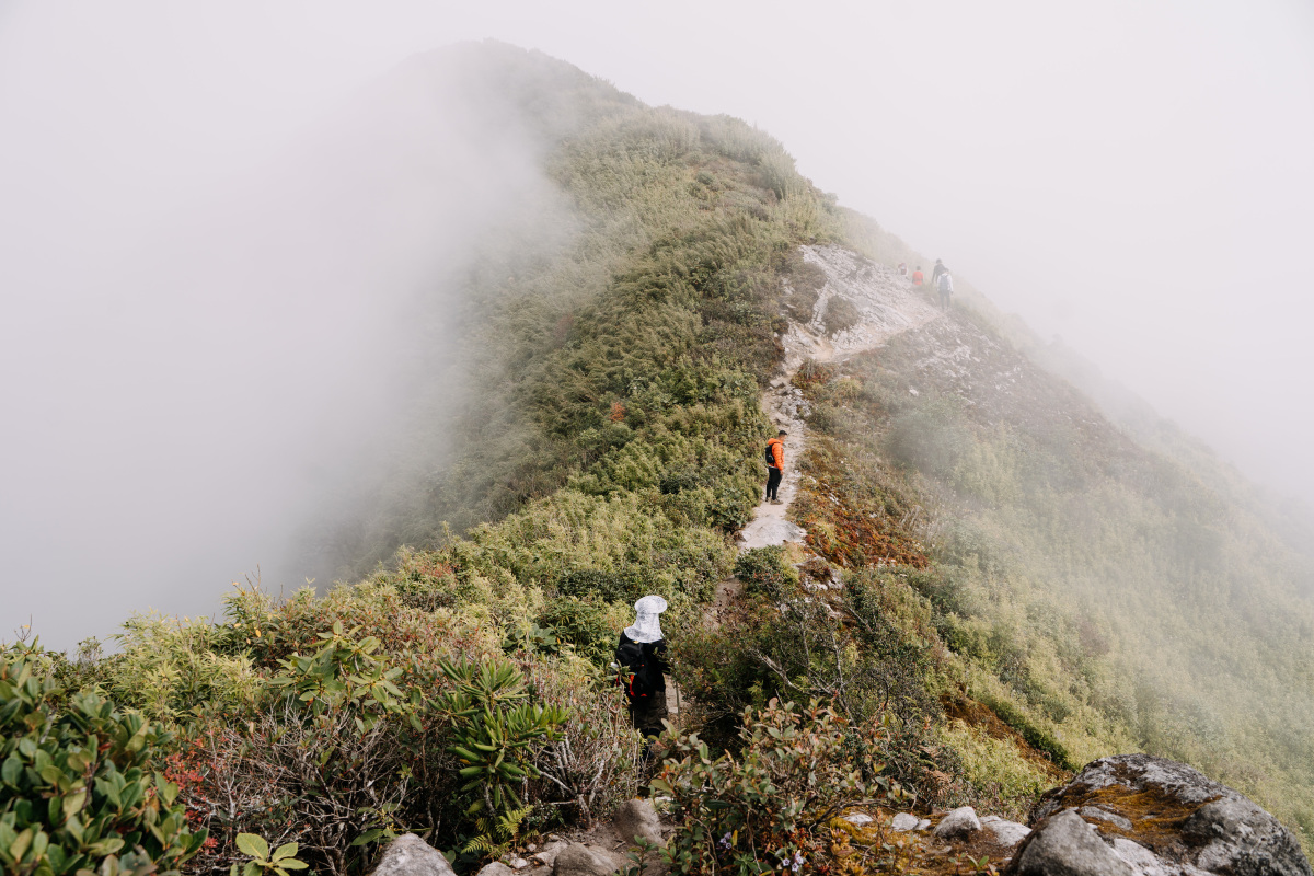
Ky Quan San, Lao Cai
Ky Quan San , or Bach Moc Luong Tu, 3,046 m high, is the second highest mountain in Lao Cai (after Fansipan). From a deserted mountain top, which was originally a place for the H’Mong to raise livestock and grow crops, in recent years, Ky Quan San has become an attractive place for those who like to climb mountains.
It will take visitors 2-3 days to conquer the road from the foot of the mountain to the top, usually from Sang Ma Sao commune, Bat Xat district. Currently, there are two climbing directions, one is from Sang Ma Sao commune, the other is from Den Sung village, Sin Sui Ho commune, Phong Tho district, Lai Chau province. Visitors can combine climbing and returning in different directions to add to the experience. Photo: Tran Trung Hieu
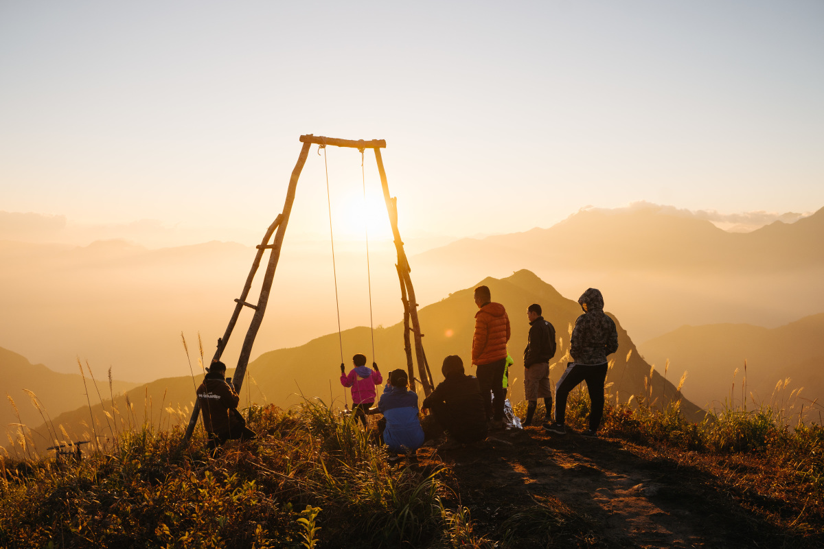
On the way, visitors not only stay overnight in a shack, go to the top to check in, but also stop at Muoi Mountain to catch the sunrise, take photos, and experience sitting on the “death swing”. At the end of this year, the Northwest weather is dry, with little rain and the temperature of the day is stable, creating favorable natural conditions to conquer the trekking arcs. Photo: Tran Trung Hieu
Follow(vnexpress)