Weather Forecast: Rain Expected in Northern Regions, Heat in the South
Weather forecasts indicate sporadic rain in the northern regions of Vietnam, while the southern areas are
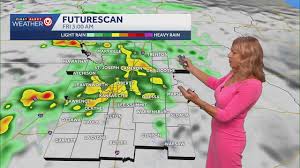
Kansas City, MO — After a relatively mild First Alert Weather Impact Day with scattered showers across the metro area, residents can expect more rain overnight leading into Friday. The showers are predicted to continue into the morning, with heavier rainfall likely, and some residual showers may linger throughout the afternoon.
Friday's high temperatures are projected to reach the upper 70s. However, the weather will take a drastic turn as the weekend approaches. By Saturday, conditions will dry out, but temperatures are set to soar back into the upper 90s. The heat index could climb to nearly 105 degrees, prompting another Impact Day due to the extreme heat.
As the heat wave continues, Sunday and Monday are designated as First Alert Weather Alert Days, with highs again expected in the mid- to upper 90s. The heat index could reach 110 degrees or higher, creating dangerous conditions for outdoor activities. Tuesday will also be marked as an Impact Day, with highs in the low to mid-90s.
Looking ahead, daily storm chances are anticipated from Tuesday through Friday, with temperatures hovering near 90 degrees and nighttime lows around 70 degrees. Residents are advised to stay updated on the weather conditions and take necessary precautions against the heat.