Northern Vietnam Braces for Heavy Rainfall
Northern Vietnam is set to experience significant rainfall starting from the night of August 17. Widespread
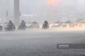
The National Center for Hydro-Meteorological Forecasting has announced that beginning early on August 21, the Northeast region of Vietnam will see moderate to heavy rain, accompanied by thunderstorms. Some areas may experience very heavy rainfall. This weather event is expected to last for an extended period.
As of the morning of August 20, regions from Thanh Hoa to the northern part of Quang Tri province have already recorded moderate to heavy rain and thunderstorms, with some locations experiencing very heavy rainfall. Rainfall amounts from 7 PM on August 19 to 8 AM on August 20 exceeded 150mm in certain areas, such as Khe La station in Nghe An, which recorded 223.8mm, and Cho Trang in Ha Tinh, which recorded 168.8mm.
From August 20 to August 21, the weather in the area from Thanh Hoa to the northern part of Quang Tri is expected to include moderate to heavy rain and thunderstorms, with average rainfall ranging from 40 to 90mm, and isolated areas may see over 180mm. In the Northeast region, from early August 21 to the evening of the same day, rainfall is predicted to be between 40 to 100mm, with some areas possibly exceeding 200mm.
There is a warning for the potential of heavy rainfall exceeding 100mm within three hours. From August 22 onward, the Northeast region and Thanh Hoa will continue to experience moderate to heavy rain and thunderstorms, with the possibility of very heavy rainfall persisting.
Additionally, the regions from the southern part of Quang Tri to Hue, as well as the Central Highlands and Southern Vietnam, are expected to see rain, with amounts ranging from 20 to 40mm, and isolated areas may experience more than 70mm of rainfall. Thunderstorms may also bring strong winds, lightning, and hail. The risk level for natural disasters due to heavy rain, tornadoes, lightning, and hail is classified as level 1.
Heavy rainfall may lead to flooding in low-lying areas, urban zones, and industrial areas, as well as flash floods in small rivers and streams, and landslides on steep slopes.