Discover Hong Linh mountain – Hoan Chau is the first scenic spot in Ha Tinh
Hong Linh Mountain is known as a sacred symbol of the Ha Tinh people and is also a favorite tourist
HA TINH – Once an important stronghold during the war, Mount Com is being planned to become a park and tourism exploitation.
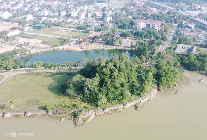
Com mountain is also known as Phong San – the name given by King Le Thanh Tong at the end of the 15th century when he rode a boat on the Lam River and came here to enjoy the scenery. The mountain is 30 m high, has a cone shape with a bottom area of more than 2,600 m2, in the vein of Lach mountain extending to the bank of Lam river, now in Xuan An town, Nghi Xuan district.
In the past, this area was densely wooded and inhabited by many animals such as monkeys, weasels, foxes, snakes, birds… Today, Com mountain is combined with two provincial-level historical and cultural relics: Gia Lach wharf – the southern abutment of Ben Thuy pontoon bridge and Gia Lach banyan tree, creating a famous scenic complex of Ha Tinh.
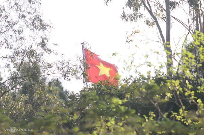
According to historical books, Mount Com is the evidence of many historical events in Nghe Tinh (present-day Nghe An and Ha Tinh). International Labor Day May 1, 1930, in response to the struggle movement of factory workers in Vinh – Ben Thuy, Ha Tinh Party Committee assigned three suicide team members of the Red Self-Defense Team : Nguyen Tien, Nguyen Canh, Le Tinh secretly climbed to the top of Mount Com, planted red flags with hammer and sickle, and distributed leaflets calling for and encouraging tens of thousands of people to rise up to fight.
The next morning, on the top of Mount Com, the red hammer and sickle flag fluttered to cheer for the workers’ unions protesting, going into factories demanding wages and reducing working hours, making the feudal colonists angry. The enemy then directed his minions to climb to the top of the mountain to lower the flag, but no one dared to approach the mountain for fear of ambush. Three days later, the enemy had to send a team of legionnaires, carrying guns and ammunition from Ha Tinh town to support in order to bring down the flag.
During the war against the US, due to its location on the North-South road and waterway, Mount Com was chosen as the forward base of the border guards. On August 5, 1964, American aircraft attacked Vinh, the main force coordinated with local people to set up an observation post and anti-aircraft gun platoon on the mountain. When the enemy bombed, the soldiers stuck to the posts, divided the fire with the army and people on both banks of the Lam River to protect the ferry wharf, the factory, and the street, helping to shoot down an American plane.
From 1964 to 1973, there was a day when the area of Com mountain and Ben Thuy ferry was rammed by enemy aircraft and ships, and fought continuously. Thousands of tons of bombs, hundreds of mines, and flares were dropped on this place to cut off the supply line of the northern rear for the southern battlefield.
In order to keep the traffic blood flowing and ensure the safety of many legions and ferries across the Lam River, the engineer dug deep at the foot of the mountain a system of trenches and tunnels to hide weapons and artillery vehicles. In addition, on the mountainside, the soldiers also created a deep tunnel to place light as a pilot for the ferry to cross the river from the north bank (Nghe An) to the south bank (Ha Tinh) at night safely.
Later, the army and people built more pontoon bridges next to the foot of the mountain so that vehicles and people could cross the river quickly to aid the battlefield in time. Here, a 70-person cargo handling team named “Steel over Lam” was born. From 1970 onwards, this force has successfully unloaded and transported millions of tons of food, food, weapons and ammunition… to aid the front lines, ensure smooth traffic, and contribute to liberation. South, unify the country.
According to the book Nghi Xuan – Monuments and Landscapes , the mountain is also associated with the legend of Mr. Dung – who had a large body, extraordinary strength, and could move mountains to fill up a lake. This character in ancient times helped people in Ke Lau and Ke Lach areas (present-day Nghi Xuan) escape the scourge of a great flood. The villagers later named the small mountain on the Lam River as Com mountain to commemorate Mr. Dung’s efforts.
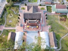
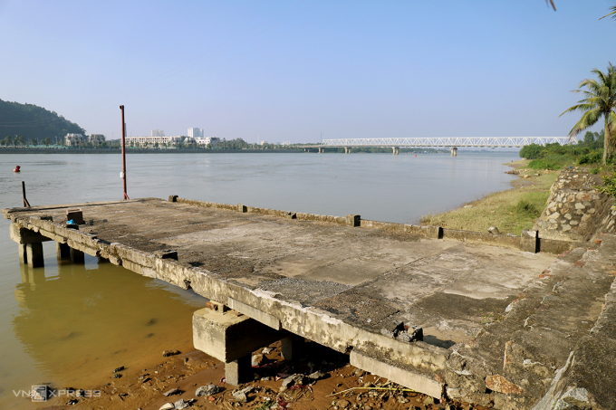
Experiencing the change of time, Com mountain is now devoid of animals, but there are still some vestiges of the command center, observatory, artillery battle, ammunition storage… At the foot of the mountain, there is an am worship for people to come and offer incense. The Ben Thuy ferry, more than 300 meters from the foot of the mountain, has been destroyed, and there are still concrete abutments and piers on the south bank. Currently, the government has built embankments around the mountain area facing the Lam River, installed a number of lighting items…
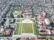
Mr. Phan Thanh La, Head of Culture and Information Office of Nghi Xuan district, assessed that Com mountain and two relics of Gia Lach wharf – abutment on the south bank of Ben Thuy pontoon bridge and Gia Lach banyan tree are discretely connected, not yet formed. common body. Many items are sloppy, wasteland. In early March, the district planned to renovate this area like a park to develop tourism and enhance the beauty of the relic cluster.