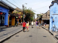

5 mountain roads in the trip through Vietnam
Thanh Tuan recorded beautiful moments on the top of Na Lay mountain, walking in Binh Lieu, watching the
As a mountainous district of Quang Nam province, located on the top of the majestic Truong Son mountain, the land of Tay Giang, which is like Da Lat in the Central region, is a very “hot” name in the “moving” map of the believer “phon”. Join Vinlove to pocket the latest Tay Giang – Quang Nam travel experience for a happy and convenient trip!
See also: 20 attractive Quang Nam tourist attractions not to be missed
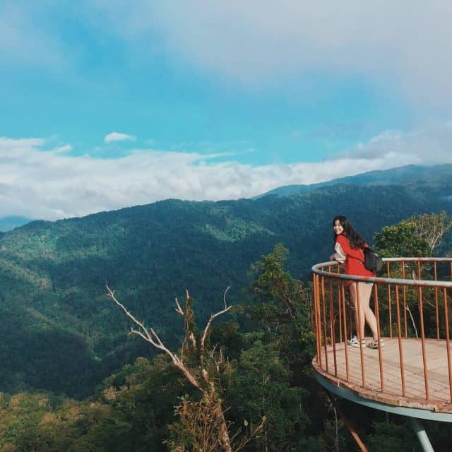
Que Peak – Tay Giang (Photo: @ tramtram_9x)
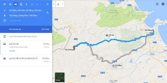
Located 120km from the center of Da Nang city, of which more than 100km are hilly roads with high, winding slopes, so you need to be sure and have experience in long-distance driving. The distance is quite far, so you should divide into 3 stops: the first one in Prao (km 80), the second in the ancient village of Co Tu (in the territory of A Tieng commune), the third one at Dinh Que area of Voong village, Tr’hy commune).
Cinnamon Peak (Photo: Collectibles)
Located at an altitude of 1300m above sea level, the road to Tay Giang is always in a state of fog, so you should note the following when traveling Tay Giang :
The essential items to bring in addition to identification papers, personal belongings, you should pay attention to bring medical sets, basic medicines, warmers: shirts, towels, gloves, sleeping bags, sims Viettel mobile phones (in Tay Giang, only Viettel can be connected). Especially, before departure, checking your car carefully for tires, brakes, gasoline, … will help you avoid problems in your journey in Tay Giang.
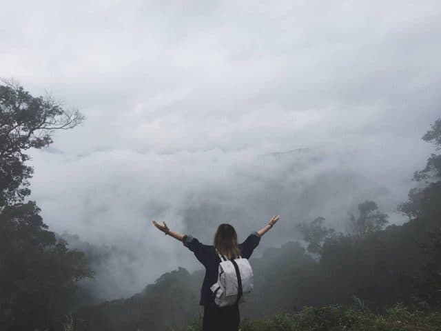
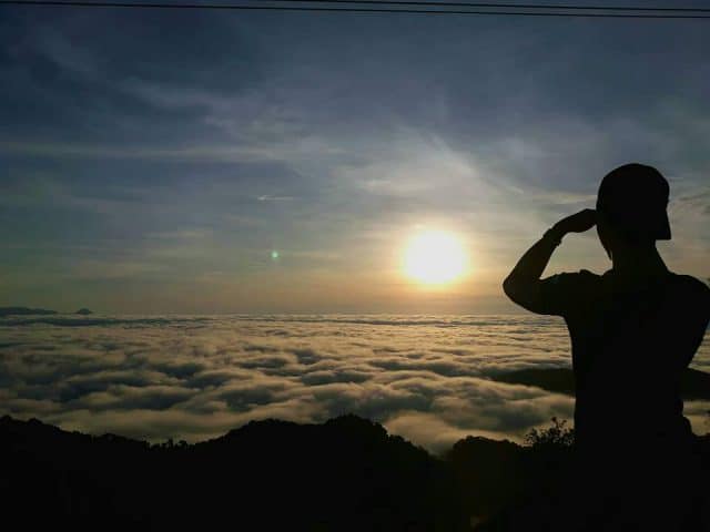
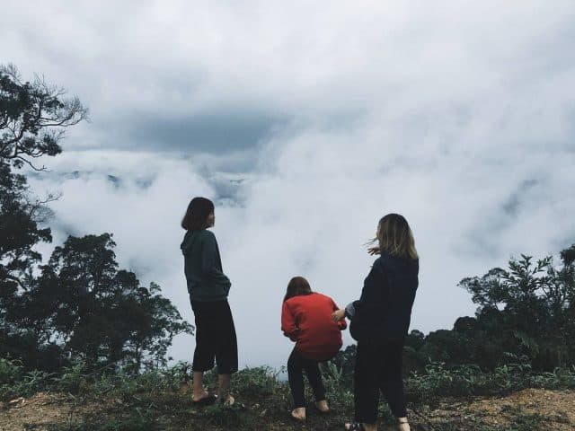
From October to February is considered the most ideal time for a successful journey “hunting clouds” Tay Giang at Que Peak. Coming to Tay Giang at this time, you will feel the full cold weather with a beautiful sea of white clouds, like a fairyland in the world.
Xiangjiang during winter days (Photo: @lalachichili)
From October to February is the right time to “hunt clouds” at the top of Que (Photo: Collectibles)
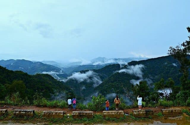
“Sea of clouds” Tay Giang (Photo: Khanh Dong Le)
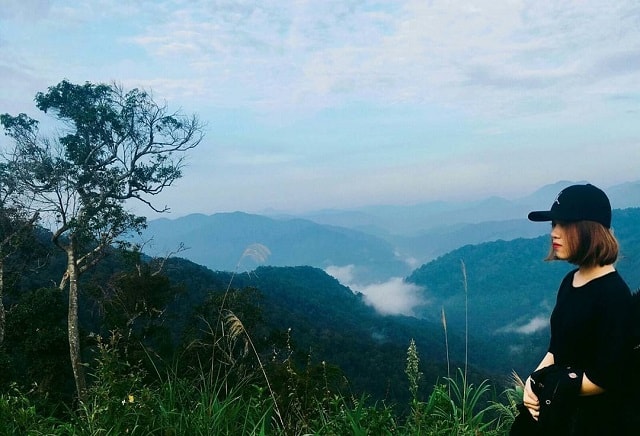
If you choose to go at another time of year, although you cannot “hunt” clouds, you can still admire a majestic Tay Giang.
Panoramic view of the majestic mountains of Tay Giang seen from Que Peak (Photo: @camtuheo)
There are two ways to move from Da Nang to Tay Giang, that is through Dong Giang and Nam Giang districts. But moving across Dong Giang district will save you more time. From Da Nang along Hoang Van Thai Street, you move to Highway 14G. Passing Doc Kien, Dong Giang, you move in the direction of Prao town, to the junction between 3 districts of Dong Giang, Nam Giang and Tay Giang, following the signboard of Tay Giang that runs straight. With this road, you will admire the green Trung Man tea hills among the majestic Truong Son mountains.
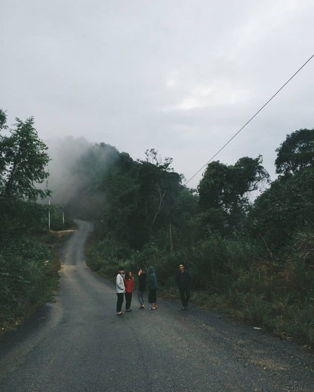
Road to Tay Giang
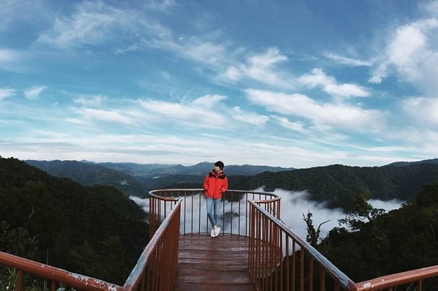
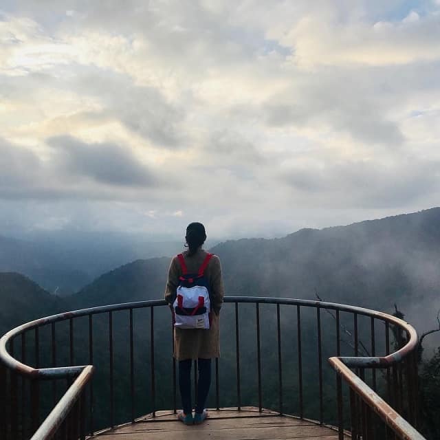
Que Peak is considered the most beautiful mountain in Quang Nam with an altitude of 1369m above sea level, so it seems to be covered all year round. Over hundreds of kilometers of passes, you will admire a beautiful scenery. It is a white “sea of clouds” under the light of dawn or sunset, sometimes it is an open landscape with floating clouds, opening up a majestic mountain and forest space. Standing at the top of Que, you will feel as if you just stretch out your hand to reach the clouds, to the sky.
(Photo: @lalachichili)
(Photo: @lalachichili)
(Photo: @ hoa_tram_91)
(Photo: Collectibles)
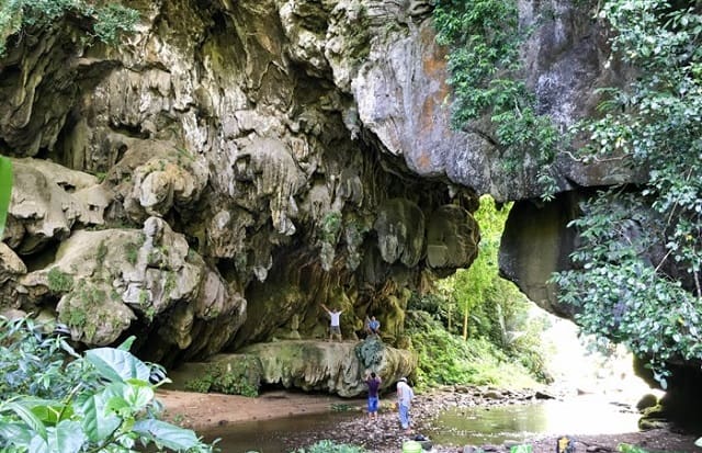
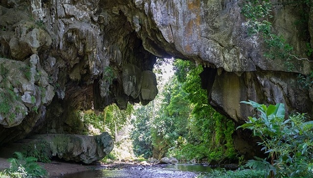
Continuing the journey, the wild but poetic scenery of the Vietnam-Laos border area gradually appeared with the mysterious “heaven gate” Azut. Sky gate as called by locals refers to a giant limestone arch with many large and small caves carrying many beautifully shaped stalactites, attracting many young people to conquer and explore.
(Photo: Collectibles)
(Photo: Collectibles)
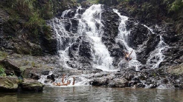
Located above Que Peak is Ra-ai waterfall standing up, day and night flowing from the top of A Rang (bordering Laos) to create white foam creating a majestic natural frame.
(Photo: Collectibles)
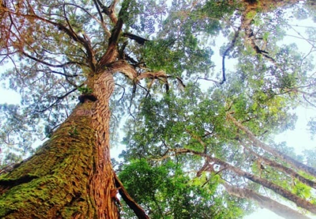
Located 10km from the top of Que, the primary forest of Pomu is the only forest in our country that still has a population of Pum heritage trees. The vast forest and mountain space with tall, moss-covered Pomu trees will help you have an exciting journey to discover the green forest.
The Pomu tree is associated with the culture and life of the Co Tu people (Photo: Collectibles)
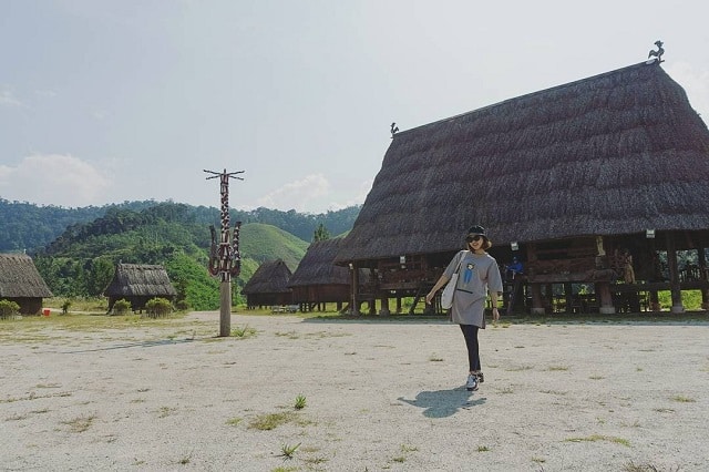
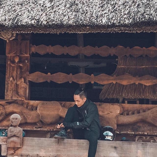
Coming to Tay Giang , you will also have the opportunity to visit the Co Tu villages with the Guol, Mool, and Long houses bearing the architectural features of the Co Tu people. As well as feel the sincerity, hospitality, and warmth of the people in the majestic Truong Son with canteens, cassava wine by the fire of the fire.
(Photo: @ vikhanh.293)
(Photo: @chungocbaotran)
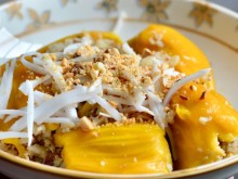
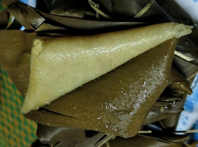
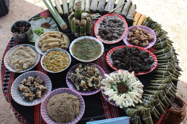
During the journey to Tay Giang , you can enjoy many traditional dishes “unique” of this land such as lam rice, croissants, zơ rua (pickled pork), zơ ra (including meat, grilled fish and vegetables in bamboo tubes), various kinds of wine, taffia, taffia, charcoal wine, …
Buffalo croissants (Photo: Collectibles)
Traditional dishes of the Co Tu people (Photo: Collectibles)
Tay Giang land is still very unspoiled with a mysterious beauty, attracting young people who are passionate about conquering and exploring. Do not hesitate anymore, carry your backpack and go to Tay Giang only! Vinlove hopes that with the experiences shared above Tay Giang you will have a convenient trip with interesting experiences.