Tropical Depression in the East Sea Unlikely to Intensify into a Storm
The National Center for Hydro-Meteorological Forecasting has reported that a tropical depression located in
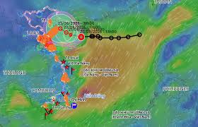
According to forecasts, a tropical depression is likely to develop in the Gulf of Tonkin, with significant rainfall expected in northern Vietnam. On the afternoon of August 20, Mai Van Khiem, Director of the National Center for Hydro-Meteorological Forecasting, reported that the tropical depression was active in the area north of Hainan Island, China, with maximum wind speeds near the center reaching level 6 (39-49 km/h) and gusts up to level 8.
The tropical depression is moving westward at a speed of 5-10 km/h. It is anticipated that by early morning on August 21, the depression will enter the Gulf of Tonkin and may strengthen into storm number 4, with an intensity of level 8 and gusts reaching level 10.
Mai Van Khiem noted that the tropical depression is currently situated on a tropical convergence zone that runs through the southern part of the Northern Delta and North Central region. As the depression remains active on this convergence zone and moves slowly, the large-scale flow patterns and interactions with surrounding weather systems are still changing. Therefore, current forecasting models show some divergence regarding its trajectory, intensity, and the areas that will be directly affected on land.
Based on current data, meteorological agencies have outlined two main scenarios for the development of the tropical depression after it enters the Gulf of Tonkin. The first scenario, which has a probability of occurrence of about 60-70%, suggests that after entering the Gulf, the tropical depression will move slowly and may strengthen into a level 8 storm. This storm would then shift northward and make landfall in the northeastern coastal area. In this scenario, heavy rainfall in northern Vietnam is expected to increase from August 21, particularly affecting the eastern region. Provinces such as Cao Bang, Thai Nguyen, Bac Ninh, Hung Yen, Hai Phong, and Quang Ninh are warned to prepare for heavy to very heavy rain.
The second scenario has a probability of about 30-40% but is considered more extreme regarding rainfall. In this scenario, after entering the Gulf of Tonkin and strengthening into a storm, it would continue to move slowly westward before making landfall in the southern part of the Northern Delta and then weakening. If this scenario occurs, the northeastern region could experience a significant amount of rain, with peak rainfall expected from August 22 to 25.
Mai Van Khiem emphasized that the forecasting scenarios may change as the tropical depression moves deeper into the Gulf of Tonkin over the next 1-2 days. Residents and local authorities are advised to closely monitor the developments of the tropical depression and remain vigilant for strong winds, heavy rain, thunderstorms, and other hazardous weather conditions that may occur at sea and on land in the coming days.