Trekking to Việt Nam’s fourth highest mountain peak
Bạch Moc Lương Tử, Viet Nam’s fourth highest peak in Lao Cai Province, is a perfect venue for viewing
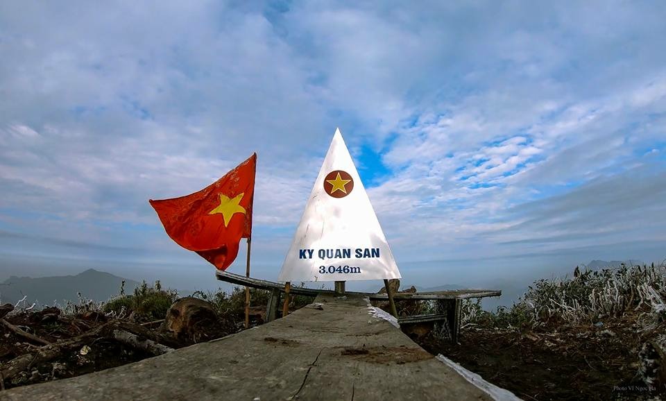
Located 3046m from sea level, Bach Moc Luong Tu (Ky Quan San) is a "heavy" trekking route for mountain climbing enthusiasts.
Referring to the high peaks in the North of our country, most tourists will remember Fansipan Peak, also known as the Roof of Indochina. However, not far away, another location is equally thorny and challenging. This place has a special name, Ky Quan San or Bach Moc Luong Tu, 60km from Sa Pa.
 Ky Quan San is a mountain stretching across the territory of two rivers: Sin Suoi Ho (Lai Chau) and Sang Ma Sao (Lao Cai). According to many backpackers, this mountain began to attract many climbers and explorers around 2012.
Located at an altitude of 3046m from sea level, Ky Quan San is one of Vietnam's 4 highest mountain peaks, possessing a diverse and highly difficult climbing terrain of Bach Moc arc, including many arcs from trekking to forests and crossing streams, cliffs or flat roads... Ky Quan San, Bach Moc Luong Tu is not a route for people with average physical strength or new to climbing but requires people with high health and endurance.
However, the above characteristics create this place's thorny and elegant beauty, stimulating visitors, especially those who love mountain climbing and trekking. Many people say that, besides Lao Than and Fansipan, if you have not set foot on Ky Quan San, you are not a true "trekking person"!
According to tourists with previous experience, there are 2 routes to the top of Ky Quan San. One is the Lao Cai - Sa Pa - Sang Ma Sao arc, the other is the Lai Chau - Den Sung arc, but the most popular one is the arc starting from Sin Suoi commune - Lao Cai due to the easier terrain and richer vegetation than the arc. Lai Chau a lot.
 The total distance from Sin Suoi commune to Ky Quan San peak is about 30km round trip. Indigenous people also proactively created a climbing trail from the village to the top with many stops to give tourists the optimal and safest exploration experience.
The ideal time to conquer Ky Quan San is in the fall and winter, when the rainy season has passed, because the road will be safer and not slippery. However, tourists who want to experience winter, especially from December to January, must be well-prepared in healthy and warm clothes before going because the weather will be very cold.
The total time to complete the Bach Moc Luong Tu trekking route is 2 - 4 days. The most reasonable and safest option for tourists, especially those who do not have much experience, is to sign up to go in a group, tour or hire a guide (Porter) to go with the price of about 250,000/ day/person. As for package tours, prices range from 4,000,000 - 5,000,000 VND.
For current and upcoming tourists intending to conquer one of the four highest peaks in our country - Ky Quan San, below is the most popular schedule used in trekking tours so that visitors can refer to it in advance.
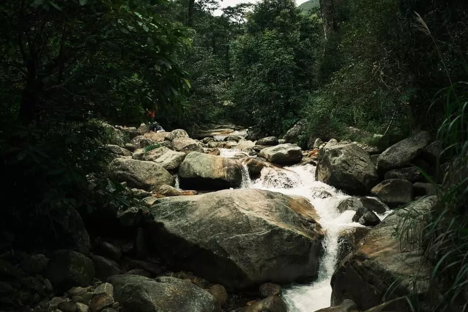
After arriving at Sa Pa port, visitors must rent a car to drive about 50km to Sang Ma Sao. Coming to Ki Quan San village - Sang Ma Sao commune, visitors will officially begin conquering the majestic mountain when fully prepared mentally healthily, luggage or supporting and protective equipment. The path to the first rest shack is mostly steep. The closer you get to the shack, the higher the slope's difficulty. After overcoming continuously high slopes, a stream and a primeval forest, visitors will arrive at the first rest stop, the 2100m high Salt Mountain slope, to rest, eat, and prepare for the next day.
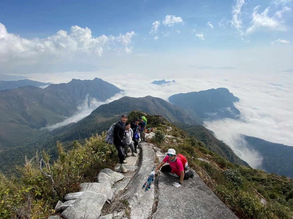
On day 2, tourists continue moving from the tent to the top. Although the road is only 4km long, it has a steeper, higher slope and is more difficult to walk, which can discourage many people. The most difficult challenge on the second day's journey is overcoming the dinosaur's spine with cliffs and strong winds on both sides.
Tourists must consider safety and follow the small stones leading to their destination. Bach Moc peak is obscured by the rolling mountains of the Bat Xat district, so it can only be seen when reaching the dinosaur's spine.
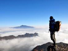
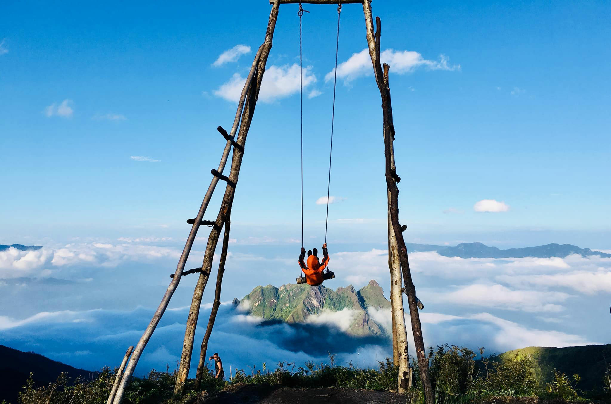
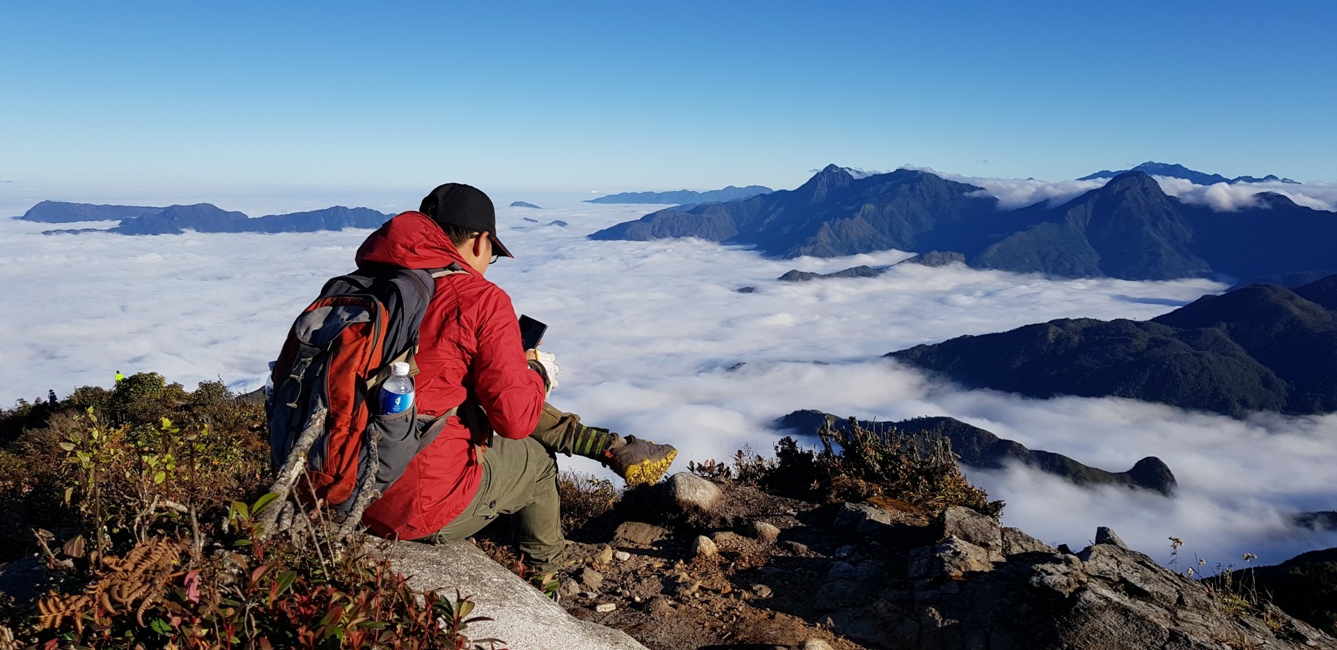
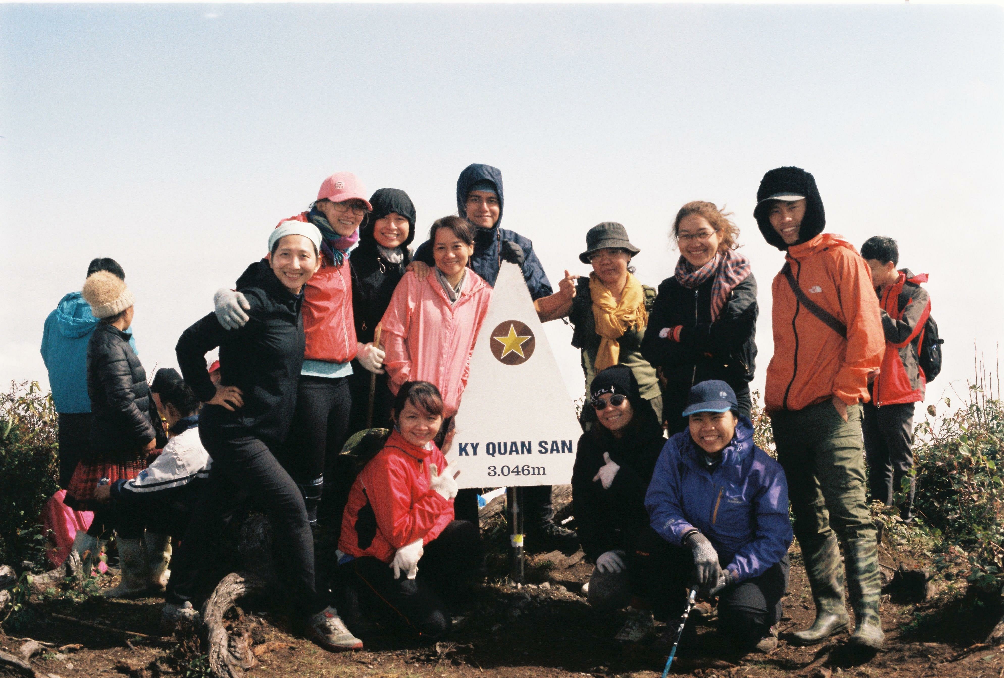
 Overcoming many difficulties and challenges, visitors will officially reach the top of Ky Quan San at an altitude of over 3000m. Visitors come here on clear days and see the vast, magical "sea of clouds". Taking check-in photos with the landmark at the top is also an experience to be noticed.
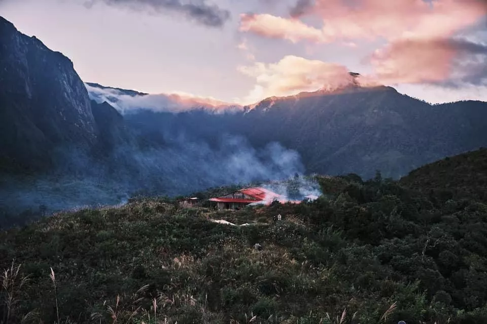
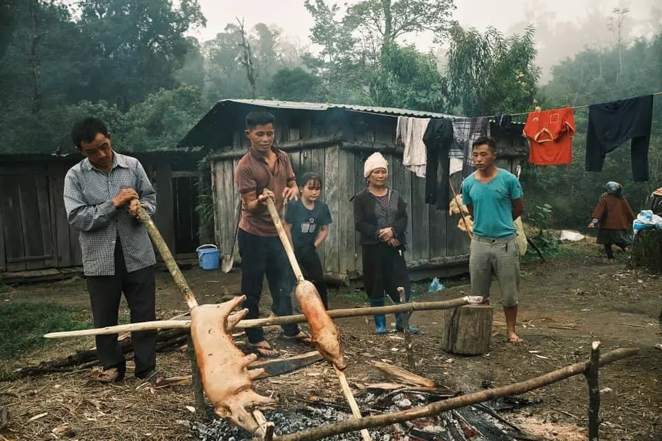
 After that, visitors will begin to descend the mountain and rest at the top of Muoi Mountain in the evening. Eating hot pot and sipping a glass of spicy Ban wine at an altitude of 2100m is a strange and unforgettable experience for anyone who has ever visited Bach Moc palace.
 Ky Quan San is the most dangerous climbing route in Vietnam, but anyone who has ever gone on it wants to come back because of the pristine terrain, separate from the outside world, and because of the feeling of breaking the limit. "Bach Moc is as beautiful as a painting. There are beautiful moments I can only stand there dumbfounded, watching, capturing with all my senses, but unable to do anything else. I thought these scenes only existed in movies and were not real, but sometimes I saw them with my eyes and was truly moved," tourist Khinh Vu Phi Duong commented after his trip.
Ky Quan San is not a trail for first-time trekkers or people with average physical fitness.