Check-in points when coming to Dien Bien Phu
DIEN BIEN – Readers Van Dat introduced attractions associated with the Dien Bien Phu campaign such as the
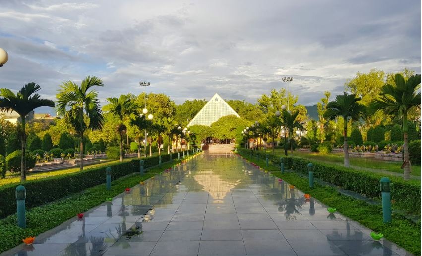
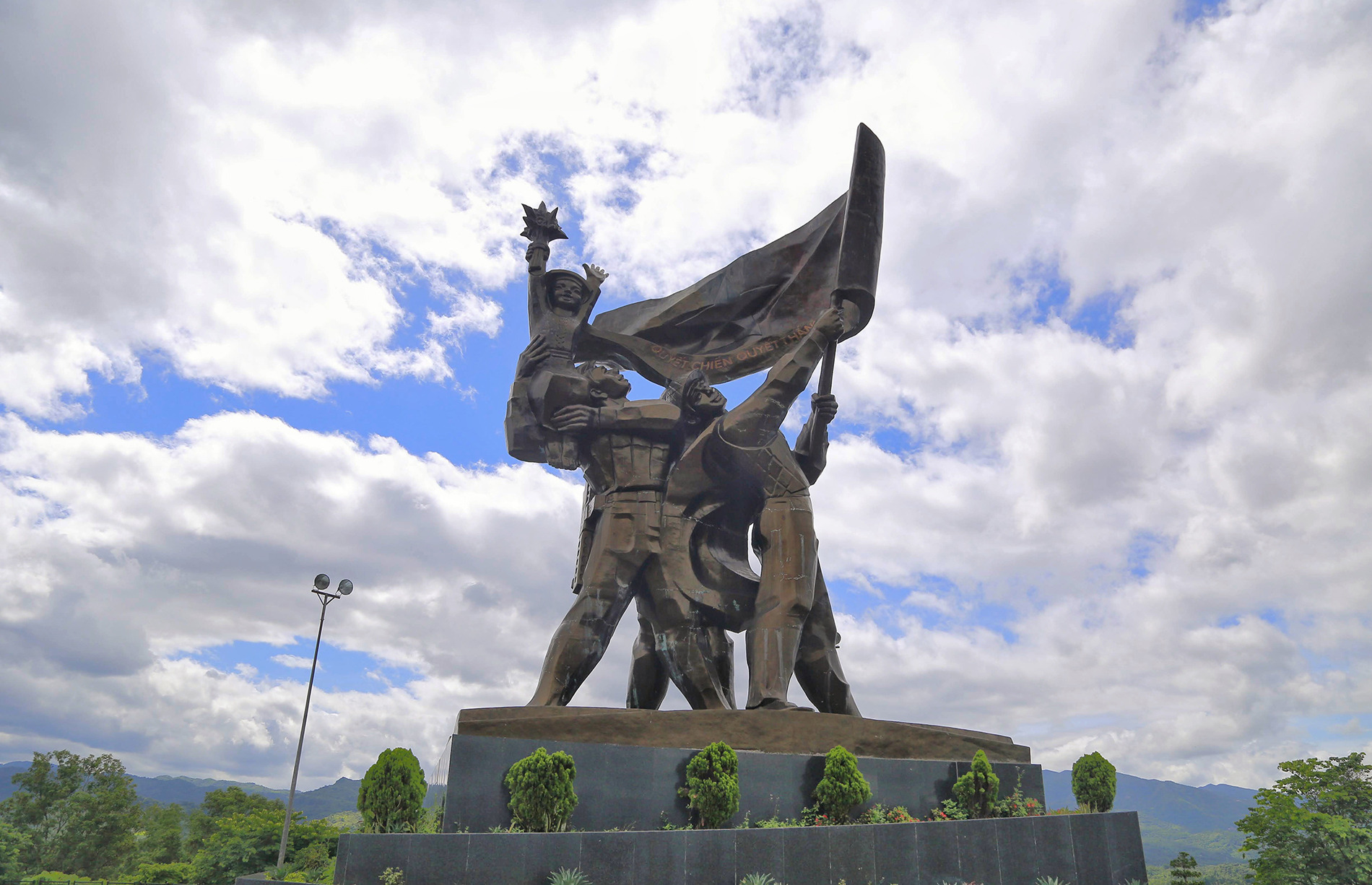 The monument was inaugurated on May 7, 2004, on the 50th anniversary of the victory of Dien Bien Phu. The project is located on hill D1, right in the city centre. This collection of monuments is the biggest, heaviest, and tallest collection of bronze statues that Vietnam has ever seen. The statue has a height of 12.6 m and was cast with 217 tons of bronze.
Also read: Check-in points when coming to Dien Bien Phu
 The cemetery is on Vo Nguyen Giap Street, a few hundred meters from A1 hill. Six hundred forty-four officers and soldiers who lost their lives during the Dien Bien Phu campaign are buried here. The manor's house has the typical stilt house architecture of the Thai people in Dien Bien, and the outside ceremony platform is designed according to Khue Van Cac.
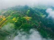
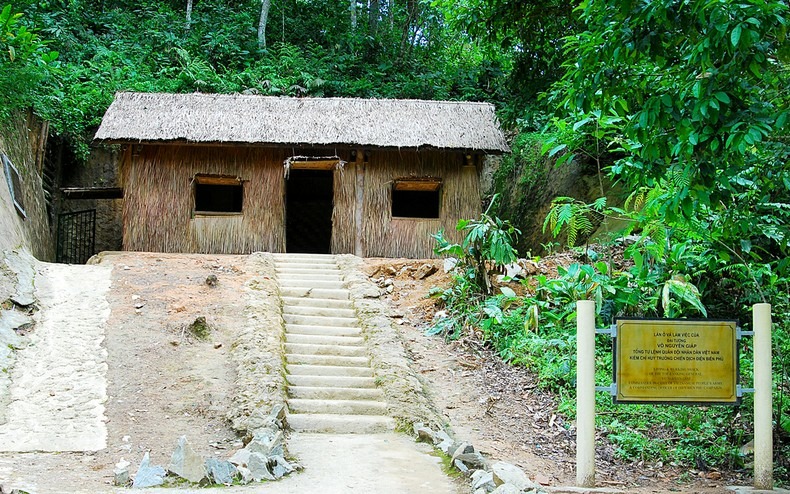
Dien Bien Phu Campaign Command Headquarters relic in Muong Phang is located at an altitude of more than 1,000 m above sea level, at the foot of Pu Don mountain, hidden under the canopy of ancient forests, more than 30 km from Dien Bien Phu city centre.
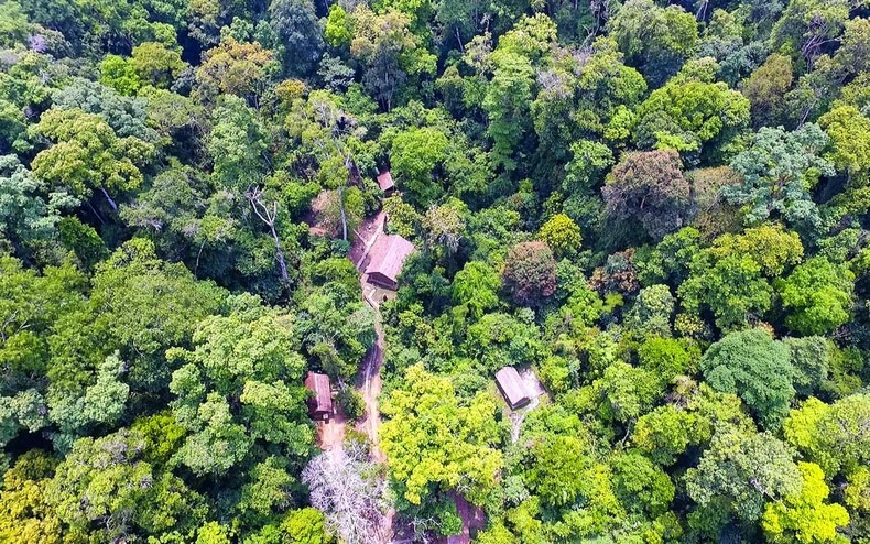 To maintain safety and secrecy, the Command Post's structures are set up in a continuous system encircled by tunnels and camps on both sides. During the campaign, General Vo Nguyen Giap worked and rested here. Many relics, such as The Living and Working Shack of the General, Deputy Chief of General Staff Hoang Van Thai, and Head of Communications Hoang Dao Thuy, retain their value.
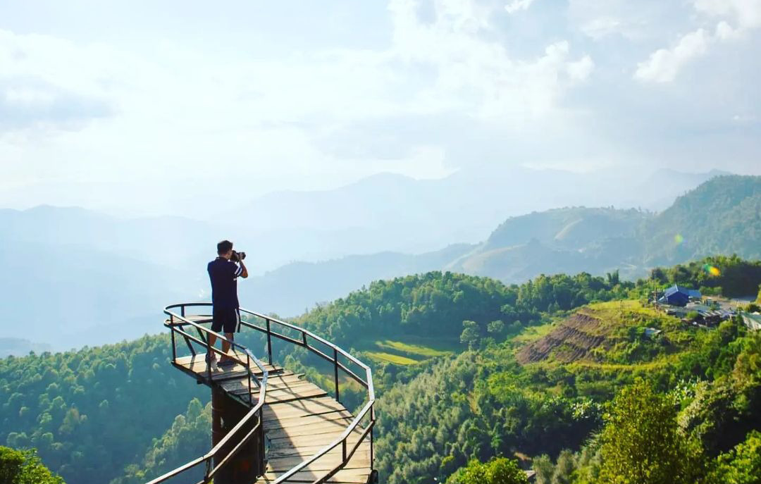
 From the highest point, visitors can observe the entire city of Dien Bien Phu, Muong Thanh Valley and French army bases such as Him Lam Hill, Doc Lap Hill, D1 Hill, C1 Hill, and A1 Hill. The Victory Monument cluster at Muong Phang Park (pictured above) is also a stop to be noticed when coming here.
In addition, in Muong Phang, a cherry garden blooms near Tet, located on an island in the middle of Pa Khoang Lake. Tourists should take time to admire the beautiful scenery here.
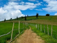
 The 32 km long Pha Din Pass, part of National Highway 6, is the entry point to the province of Dien Bien. The highest point of the pass is 1,648 m above sea level; one side is a cliff, and the other is an abyss. This is also the starting place of the journey of pulling artillery and transporting food, weapons and ammunition using the human power of the Vietnamese army and people during the Dien Bien Phu campaign.
Although the small roads have been enlarged, and the Pha Din Pass is no longer as difficult as it once was, there are still several twists and zigzag roads. The Pha Din Pass tourist area is located on Pha Din Pass and serves as both a rest stop and meeting point for visitors to enjoy the beauty and a venue for interactions between residents of the provinces of Dien Bien and Son La.
Read more: Top 13 most dangerous and conquering passes in Vietnam
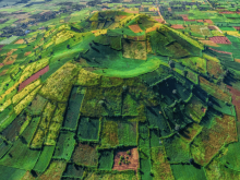
In the middle of the Dien Bien basin, Muong Thanh field is like a giant "warehouse" filled with corn and rice. From the end of September, rice in the Muong Thanh basin begins to ripen. Muong Thanh field, located more than 400 m above sea level, stretches over 20 km, with an average width of 6 km. Looking down from above, the Muong Thanh field running along the banks of the Nam Rom River spreads out like flower petals, embracing the historical relics of the Dien Bien Phu battle.
Muong Nhe is a district northwest of the province, where the westernmost point of Vietnam is located, the Vietnam - Laos - China border junction, about 250 km from Dien Bien Phu city centre. The terrain here is mainly forest, accounting for 55% of the area. In addition, this place also has Muong Nhe Nature Reserve, one of the largest special-use forests in Vietnam with a diverse ecosystem.
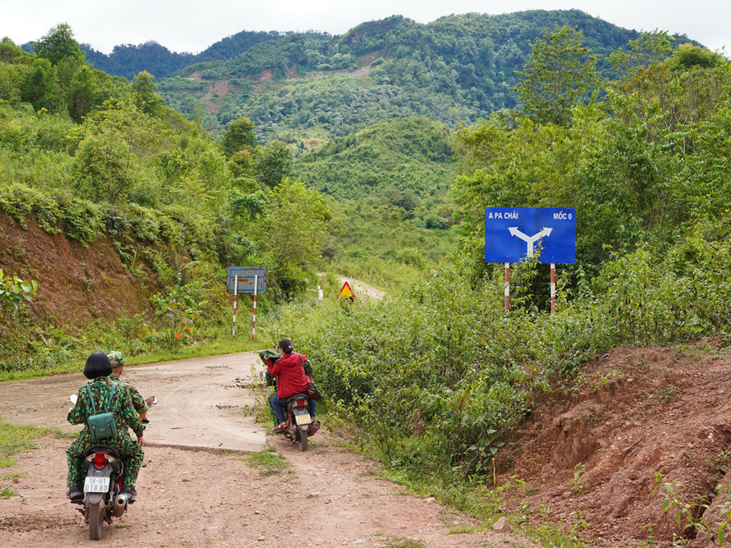 A Pa Chai is the most famous destination in Muong Nhe, where coordinate milestone 0 is at the top of Khoan La San mountain. Three countries installed the milestone on June 27, 2005. It is made of granite, with each side engraved with the country's name and national emblem. Every month on the third, thirteenth, and twenty-third days, A Pa Chai, a cultural gem of the border region, holds its market.
The road to A Pa Chai is quite easy in the dry season, but the roads become difficult, even dangerous in the rainy season. Visitors should have a guide to ensure safety.
Considered the capital of the White Thai people, Muong Lay town offers visitors a chance to cruise the Da River, take in the breathtaking scenery, and discover more about Thai culture and way of life. The Hang Tom Bridge, which links the provinces of Dien Bien and Lai Chau, is a must-see destination for tourists visiting Muong Lay.

When the former Hang Tom Bridge was constructed in 1967, it was the biggest cable-stayed bridge in Indochina. Water from the Son La hydroelectric plant accumulated in November 2012, forcing the Da River lake to swallow up the entire historic Muong Lay town, including the Hang Tom bridge. A new bridge 70 meters taller than the old one has been built close to the old Hang Tom bridge site.
Read more: The 5 most beautiful tourist destinations in the North can not be missed