India weather forecast latest January 6 Widespread rain accompanied with thunderstorm and lightning over northwest areas
strong Thunderstorm hail and lightning are forecasted to cover at several parts of northwestern plains
According to Skymet Weather, a Western Disturbance over Jammu and Kashmir and adjoining parts is moving ahead. The cyclonic circulation over Rajasthan has now reached close to Maharashtra.
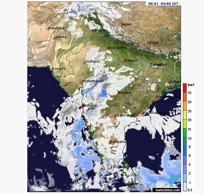
A trough is formed from the southern-central parts of the Arabian Sea to northern central Maharashtra. Due to this, weather changes are seen over Maharashtra.
Apart from this, another trough is formed from Sri Lanka to coastal Andhra Pradesh via coastal Tamil Nadu. An anti-cyclonic circulation is now visible over Odisha and adjoining areas.
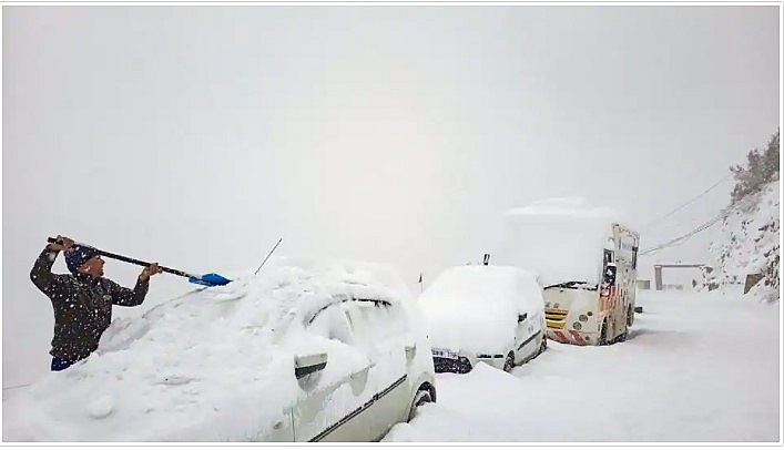
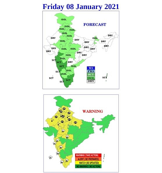
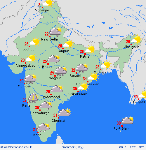
During the next 24 hours, moderate rains and snow are likely to continue over the western Himalayan states. Light to moderate rain and thundershowers may fall over western Uttar Pradesh, while one or two places of Haryana, Punjab and Delhi.
Coastal Tamil Nadu and Kerala may receive light to moderate rains with heavy showers at some places.
Light to moderate rains may occur over Karnataka, Interior Tamil Nadu, South Konkan and Goa, South Central Maharashtra, Marathwada and Vidarbha. The possibility of sporadic rain in Telangana cannot be ruled out.
Rain over plains of northwest India is likely to reduce or stop completely from today, according to India Meteorological Department (IMD). Heavy to very heavy rains are however likely to persist over many parts of peninsular India due to intense easterly waves
The Western Disturbance which brought rain and snow to the hills in the past four days has moved away and the moisture feed from Arabian Sea has significantly reduced, according to IMD’s Wednesday bulletin. Scattered snowfall is likely over Jammu-Kashmir-Muzaffarabad-Gilgit-Baltistan-Ladakh, Himachal Pradesh and Uttarakhand. Light rainfall is also likely over Punjab, Haryana-Chandigarh-Delhi and east Rajasthan and scattered rainfall over West Uttar Pradesh. Dry weather is likely to set in over the northern plains from Thursday.
A feeble Western Disturbance is likely to impact only the Western Himalayan region on Thursday and Friday bringing light rain and snow in the hills.
Under the influence of a trough (area of low pressure) from central parts of south Arabian Sea to north Madhya Maharashtra and an active easterly wave spell, scattered to fairly widespread rain accompanied with thunderstorm, lightning is likely over southern peninsular India during the next 3-4 days.
Heavy to very heavy rain is likely over Tamil Nadu, Puducherry and Karaikal and isolated heavy rainfall over Kerala, Mahe, coastal Andhra Pradesh and Rayalaseema is also likely, reported Hindustan Times.
Minimum temperatures are likely to fall again by 4 to 6 degree C over plains of northwest India during the next 4-5 days. Cold wave conditions are likely over plains from January 11 to 13. Due to abundant moisture and other favourable meteorological features, dense to very dense fog is likely in many pockets over northwest India between January 7 and 10.
“When Western Disturbances bring rain to northwest India, easterly waves affect the peninsular region particularly Tamil Nadu. The northeast monsoon also hasn’t withdrawn completely from there. The easterly waves have been intense with moisture feeding in from the ocean. We are expecting more rains in peninsular India in the next few days,” said K Sathi Devi, head, national weather forecasting centre.
“Chennai’s Minabakkam and Nungabakkam recorded very heavy rains on Wednesday, a record definitely in the past decade and possibly many more decades. Rains reduce in January and normal are extremely low in February and March. So, this is unseasonal and unexpected. There have been record rains in many parts of northwest India due to a slow-moving western disturbance that persisted for 3 to 4 days and an induced cyclonic circulation over west Rajasthan which also persisted. Now again unseasonal rains are expected over Karnataka and parts of Maharashtra because a trough (line of low pressure) is extending from Arabian Sea to Madhya Maharashtra. Light snowfall is likely over the western Himalayas again on January 8 due to an approaching Western Disturbance,” said Mahesh Palawat, vice president, climate change and meteorology at Skymet Weather.


